Tropical Storm Laura
Laura is the earliest named 12th storm ever in history with a very active Atlantic hurricane season this year.
Below we have the latest update as of Saturday 2PM Aug 23 from NHC.
UPDATE #1: We are now out of the path of tropical storm Laura and predict zero impacts.
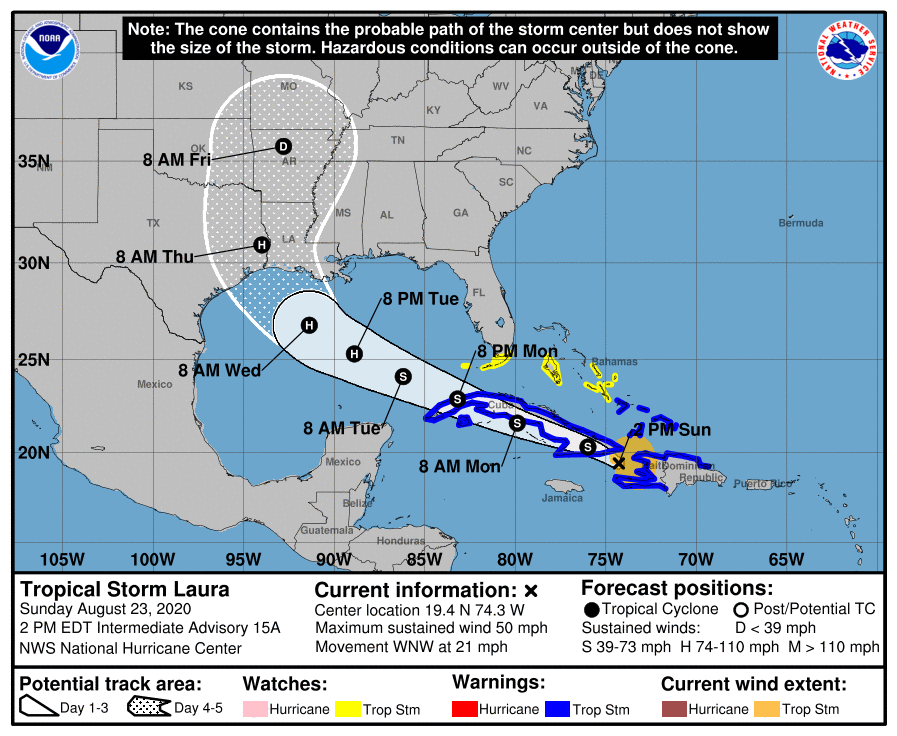
At Homelax we always try provide the latest and up to date informations regarding a potential storm who may affect our client's properties. At the time of this post and it's predicted path we see IMPACT on Southwest Florida. We may have a chance of 15-20% to experience heavy and gusty winds with up to 40 MPH
The storm Laura shows potential to be increasing in speed and being upgraded to a Hurricane close to landfall. We do not have enough information to determine the exact impact and strength, but later this weekend we may know more information based on local officials.
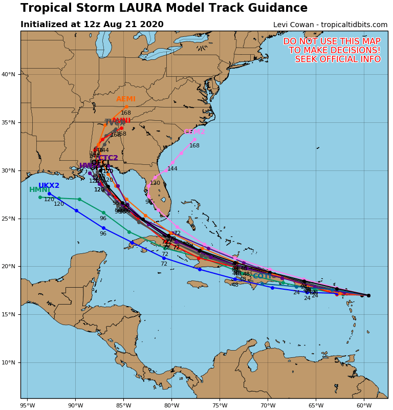
Below we have a spaghetti model showcasing it's predicted path with a common trend to move west.
Unauthorized use and/or duplication of this material without express and written permission from this site’s author and/or owner is strictly prohibited.